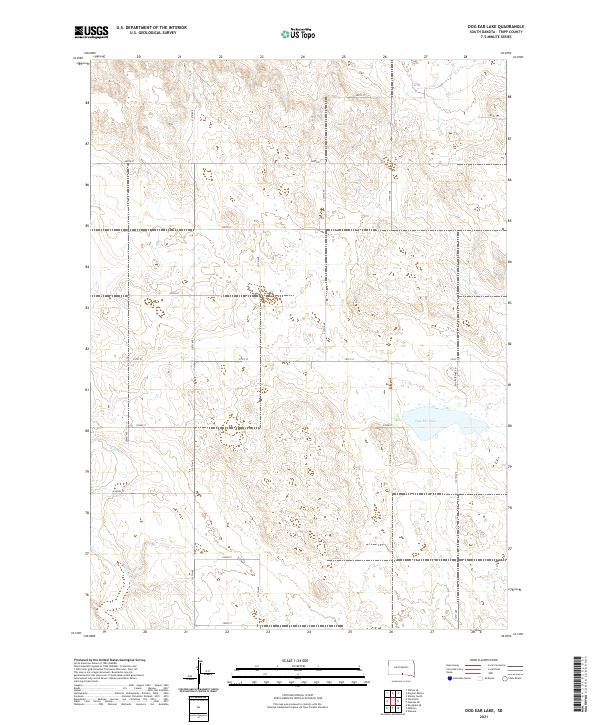
2021 Map of Dog Ear Lake
USGS Topo · Published 2021About this map
Dog Ear Lake dominates the eastern portion of this high plains landscape, situated within a section-line grid of rural roads in south-central South Dakota. The terrain is defined by its subtle drainage patterns, most notably the winding course of Willow Cr which cuts through the southwestern corner of the quadrangle. As captured by the U.S. Geological Survey, the area reflects the enduring homestead-style settlement patterns of the region, where gravel and dirt roads like Dog Ear Lake Rd follow rigid township lines through townships T97N R77W and T96N R76W. This map provides a look at the hydrography of the Great Plains before modern seasonal changes or agricultural shifts might alter the footprint of the lake and its surrounding wetlands.
Find a feature on this map
22 named features on this map. Tap any name to fly to it.
Don’t see what you’re looking for? This feature index may not catch every label — zoom into the map to look around manually.
Map Details
Editions of this 2021 Dog Ear Lake Map
This is the sole edition of this map. No revisions or reprints were ever made.
Other maps of this area

1955 · Martin
USGS Topo · 1:250,000

1955 · Mitchell
USGS Topo · 1:250,000

1958 · Martin
USGS Topo · 1:250,000

1959 · Mitchell
USGS Topo · 1:250,000
1982 · Wewela
USGS Topo · 1:24,000

1982 · Witten SE
USGS Topo · 1:25,000
1982 · Millboro
USGS Topo · 1:24,000

1982 · Keyapaha SE
USGS Topo · 1:24,000

1982 · Winner South
USGS Topo · 1:25,000
1982 · Wewela NE
USGS Topo · 1:24,000