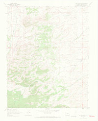
1967 Map of Dog Mountain
USGS Topo · Published 1969About this map
Rio Grande National Forest dominates this section of the high country, where a network of watercourses and primitive tracks defines the landscape. The terrain is centered around high points like Dog Mountain and Pup Peak, with drainage systems including San Francisco Creek and the branching Raton Creek network. Evidence of mountain passage and early land use is found in the Bonafacio Trail and several Pack Trails and Jeep Trails that traverse the gulches. A single Dry Creek Corral near the southern boundary suggests seasonal ranching activity or livestock management in an otherwise wild environment. For hydrologists and local historians, the presence of a Gaging Sta on the upper reaches of the creek provides a specific point of reference for historical water management and stream monitoring in this drainage basin.
Find a feature on this map
22 named features on this map. Tap any name to fly to it.
Don’t see what you’re looking for? This feature index may not catch every label — zoom into the map to look around manually.
Map Details
Editions of this 1967 Dog Mountain Map
3 editions found
Other maps of this area

1915 · Del Norte
USGS Topo · 1:125,000

1917 · Del Norte
USGS Topo · 1:125,000

1922 · Conejos
USGS Topo · 1:125,000

1945 · Durango
USGS Topo · 1:250,000

1953 · Durango
USGS Topo · 1:250,000

1954 · Durango
USGS Topo · 1:250,000

1961 · Durango
USGS Topo · 1:250,000

1963 · Durango
USGS Topo · 1:250,000

1964 · Sevenmile Plaza
USGS Topo · 1:24,000

1964 · Monte Vista
USGS Topo · 1:24,000