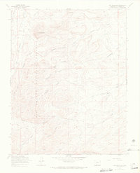
1967 Map of Dog Mountain
USGS Topo · Published 1969About this map
Rio Grande National Forest dominates this high-altitude landscape of southern Colorado, where the terrain is defined by complex drainage systems and named peaks. The water network is highly detailed, featuring the convergence of the North Fork American Creek and South Fork American Creek alongside seasonal drainages like Dry Pole Creek and Limekiln Creek. A notable landmark is Deadmans Cave, positioned on the western slopes of a ridge system between Dog Mountain and Pup Peak. The map provides evidence of land use through the presence of a Dry Creek Corral and a Gaging Sta along San Francisco Creek. Remote access is indicated by the Gopher Trail and Bonafacio Trail, which navigate the steep canyons and gulches of the Rio Grande backcountry during the late 1960s.
Find a feature on this map
21 named features on this map. Tap any name to fly to it.
Don’t see what you’re looking for? This feature index may not catch every label — zoom into the map to look around manually.
Map Details
Editions of this 1967 Dog Mountain Map
3 editions found
Other maps of this area

1915 · Del Norte
USGS Topo · 1:125,000

1917 · Del Norte
USGS Topo · 1:125,000

1922 · Conejos
USGS Topo · 1:125,000

1945 · Durango
USGS Topo · 1:250,000

1953 · Durango
USGS Topo · 1:250,000

1954 · Durango
USGS Topo · 1:250,000

1961 · Durango
USGS Topo · 1:250,000

1963 · Durango
USGS Topo · 1:250,000

1964 · Sevenmile Plaza
USGS Topo · 1:24,000

1964 · Monte Vista
USGS Topo · 1:24,000