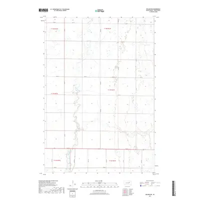
2017 Map of Doland NW
USGS Topo · Published 2017About this map
Timber Creek meanders through the heart of this Spink County landscape, shaping the subtle topography of the glacial till plains. The waterway, also labeled as Timber Cr, follows a winding course that cuts through the agricultural grid established by the Public Land Survey System. The map highlights a network of rural section lines and county thoroughfares, including Co Rd 14 and 172nd St, which serve as the primary conduits for this farming region. This survey represents a modern look at the rural infrastructure of central South Dakota, where the interplay between natural drainage patterns and human-engineered section roads defines the movement of people and resources across the prairie.
Find a feature on this map
14 named features on this map. Tap any name to fly to it.
Don’t see what you’re looking for? This feature index may not catch every label — zoom into the map to look around manually.
Map Details
Editions of this 2017 Doland NW Map
This is the sole edition of this map. No revisions or reprints were ever made.
Other maps of this area

1894 · Conde
USGS Topo · 1:62,500

1895 · Byron
USGS Topo · 1:125,000

1895 · Aberdeen
USGS Topo · 1:125,000

1953 · Frankfort
USGS Topo · 1:24,000

1953 · Huron
USGS Topo · 1:250,000

1954 · Aberdeen
USGS Topo · 1:250,000

1954 · Huron
USGS Topo · 1:250,000

1956 · Aberdeen
USGS Topo · 1:250,000

1956 · Glendale Colony
USGS Topo · 1:24,000

1956 · Doland SW
USGS Topo · 1:24,000
Featured Places
- Harmony Township, SD
- Prairie Center Township, SD
- Sumner Township, SD
- Belle Plaine Township, SD
- Clifton Township, SD