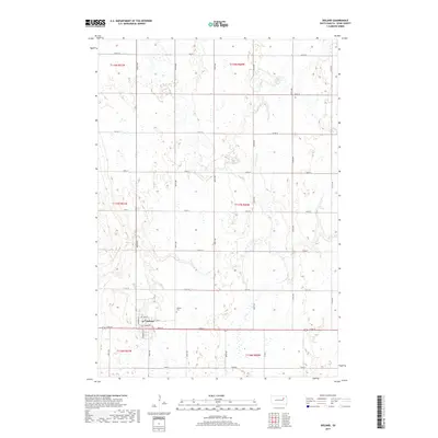
2017 Map of Doland
USGS Topo · Published 2017About this map
Doland serves as the central hub for this portion of eastern South Dakota, positioned at the intersection of Main St and Centennial Rd. The landscape is defined by the strict rectangular grid of the Public Land Survey System, with section lines marked by an extensive network of local roads such as 165th St and 411th Ave. This layout reflects the area's agricultural foundation, where farmsteads are distributed across townships including t117n r60w and t118n r61w. Just east of the primary settlement, the Doland Cem stands as a significant site for local family history and genealogical research. The terrain is characterized by numerous small depressions and seasonal wetlands typical of the glaciated plains, with Spring Rd cutting through the open country north of the town center.
Find a feature on this map
33 named features on this map. Tap any name to fly to it.
Don’t see what you’re looking for? This feature index may not catch every label — zoom into the map to look around manually.
Map Details
Editions of this 2017 Doland Map
This is the sole edition of this map. No revisions or reprints were ever made.
Other maps of this area

1894 · Conde
USGS Topo · 1:62,500

1895 · Byron
USGS Topo · 1:125,000

1895 · Aberdeen
USGS Topo · 1:125,000

1953 · Milbank
USGS Topo · 1:250,000

1953 · Huron
USGS Topo · 1:250,000

1953 · Watertown
USGS Topo · 1:250,000

1954 · Aberdeen
USGS Topo · 1:250,000

1954 · Huron
USGS Topo · 1:250,000

1956 · Aberdeen
USGS Topo · 1:250,000

1956 · Doland SW
USGS Topo · 1:24,000
Featured Places
- Doland, SD
- Turton Township, SD
- Prairie Center Township, SD
- Sumner Township, SD
- Belle Plaine Township, SD