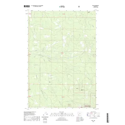
2020 Map of Dole
USGS Topo · Published 2020About this map
Dole sits at the heart of this landscape in Clark County, where the valley floor meets the rising timberlands of the Gifford Pinchot National Forest. The East Fork Lewis River carves a path through the center of the sheet, marked by the presence of Horseshoe Falls. This area is characterized by a dense network of forest service and county roads, such as NE Dole Valley Rd and NE Sunset Falls Rd, which provide access to the various drainages including Roger Cr and Rock Cr. High points like Kloochman Butte and Spotted Deer Mtn overlook the Yacolt Reservoir, illustrating the intersection of water management and recreational geography. The Bells Mountain Trail offers a path through the southern ridges, reflecting the modern utility of these once-remote logging and agricultural corridors.
Find a feature on this map
47 named features on this map. Tap any name to fly to it.
Don’t see what you’re looking for? This feature index may not catch every label — zoom into the map to look around manually.
Map Details
Editions of this 2020 Dole Map
This is the sole edition of this map. No revisions or reprints were ever made.
Other maps of this area

1918 · Troutdale
USGS Topo · 1:62,500

1934 · Troutdale
USGS Topo · 1:48,000

1940 · Lookout Mtn
USGS Topo · 1:62,500

1941 · Yacolt
USGS Topo · 1:62,500

1941 · Camas
USGS Topo · 1:62,500

1942 · Camas
USGS Topo · 1:62,500

1948 · Vancouver
USGS Topo · 1:250,000

1950 · Vancouver
USGS Topo · 1:250,000

1950 · Vancouver
USGS Topo · 1:250,000

1953 · Lookout Mtn
USGS Topo · 1:62,500