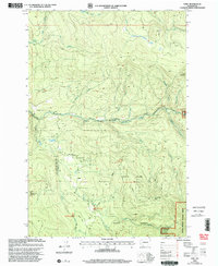
2000 Map of Dole
USGS Topo · Published 2003About this map
Dole sits at the heart of this landscape, positioned within the Dole Valley where the East Fork Lewis River carves through the terrain. The area is defined by its recovery and recreational use following historical timber activity, notably marked by the Yacolt Burn and the sprawling Gifford Pinchot National Forest. This 2000 revision highlights a network of forest management and outdoor access, including the Tarbell Trail and several established sites like the Cold Creek Campground and Rock Creek Campground.
Find a feature on this map
32 named features on this map. Tap any name to fly to it.
Don’t see what you’re looking for? This feature index may not catch every label — zoom into the map to look around manually.
Map Details
Editions of this 2000 Dole Map
This is the sole edition of this map. No revisions or reprints were ever made.
Other maps of this area

1918 · Troutdale
USGS Topo · 1:62,500

1934 · Troutdale
USGS Topo · 1:48,000

1940 · Lookout Mtn
USGS Topo · 1:62,500

1941 · Yacolt
USGS Topo · 1:62,500

1941 · Camas
USGS Topo · 1:62,500

1942 · Camas
USGS Topo · 1:62,500

1948 · Vancouver
USGS Topo · 1:250,000

1950 · Vancouver
USGS Topo · 1:250,000

1950 · Vancouver
USGS Topo · 1:250,000

1953 · Lookout Mtn
USGS Topo · 1:62,500