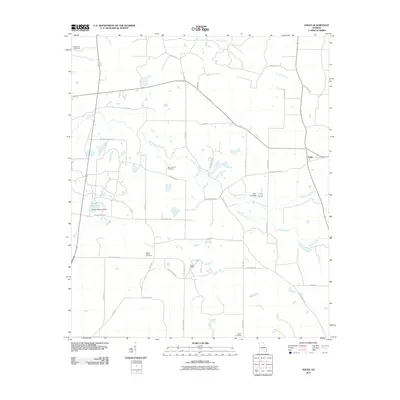
2011 Map of Doles
USGS Topo · Published 2011About this map
Abrams Creek and its many tributaries, including Little Abrams Creek and Mill Creek, define the drainage patterns of this rural Georgia landscape. The settlement of Doles serves as a local focal point in the northeastern corner, while Camp Osborn occupies a position further south. This landscape is marked by several long-established burial grounds that offer significant value for genealogical research, such as Pinder Town Cemetery, Mount Horeb Cemetery, Saint James Cemetery, and Salem Cemetery. The presence of Mercer Millpond and its associated Mercer Millpond Dam, along with Tison Lake, suggests a history of water management for local agriculture or industry. A dense network of local roads like Mercer Mill Rd and Story Rd connects these scattered landmarks and water features.
Find a feature on this map
36 named features on this map. Tap any name to fly to it.
Don’t see what you’re looking for? This feature index may not catch every label — zoom into the map to look around manually.
Map Details
Editions of this 2011 Doles Map
This is the sole edition of this map. No revisions or reprints were ever made.
Other maps of this area

1953 · Dothan
USGS Topo · 1:250,000

1953 · Waycross
USGS Topo · 1:250,000

1954 · Dothan
USGS Topo · 1:250,000

1955 · Dothan
USGS Topo · 1:250,000

1956 · Albany East
USGS Topo · 1:24,000

1956 · Sylvester
USGS Topo · 1:62,500

1956 · Albany
USGS Topo · 1:62,500

1956 · Leslie
USGS Topo · 1:62,500

1958 · Waycross
USGS Topo · 1:250,000

1972 · Cuffietown
USGS Topo · 1:24,000