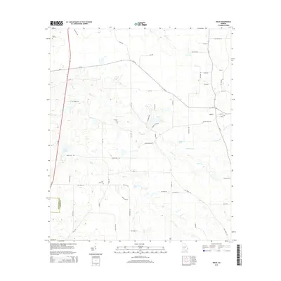
2014 Map of Doles
USGS Topo · Published 2014About this map
Mt Horeb Cem and Saint James Cem anchor the rural landscape of Worth and Dougherty counties, where family-named landmarks and winding watercourses define the settlement pattern. In this agrarian corridor, the small community of Doles sits at the intersection of Ga-313 and Ga-32, serving as a focal point for a region drained by Abrams Cr and Mill Cr. The landscape is dotted with private water features such as Tison Lake and the Mercer Millpond near the western boundary. A dense network of local roads like Cowford Bridge Rd and Egypt Rd connects the scattered homesteads and burial grounds, including Pinder Town Cem and Providence Cem, which provide essential touchpoints for genealogists researching South Georgia roots. The mapping captures the area's transition into the early 21st century, showing the persistent rural character of the Georgia plains.
Find a feature on this map
59 named features on this map. Tap any name to fly to it.
Don’t see what you’re looking for? This feature index may not catch every label — zoom into the map to look around manually.
Map Details
Editions of this 2014 Doles Map
This is the sole edition of this map. No revisions or reprints were ever made.
Other maps of this area

1953 · Dothan
USGS Topo · 1:250,000

1953 · Waycross
USGS Topo · 1:250,000

1954 · Dothan
USGS Topo · 1:250,000

1955 · Dothan
USGS Topo · 1:250,000

1956 · Albany East
USGS Topo · 1:24,000

1956 · Sylvester
USGS Topo · 1:62,500

1956 · Albany
USGS Topo · 1:62,500

1956 · Leslie
USGS Topo · 1:62,500

1958 · Waycross
USGS Topo · 1:250,000

1972 · Cuffietown
USGS Topo · 1:24,000