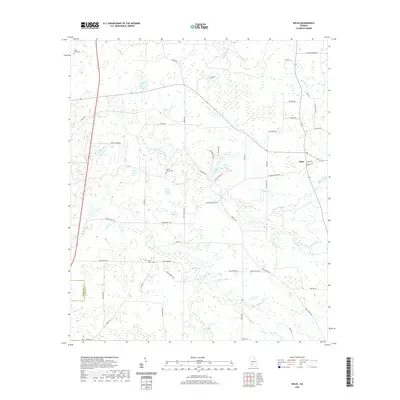
2020 Map of Doles
USGS Topo · Published 2020About this map
Abrams Cr and its tributaries, including Little Abrams Cr, carve through this section of Worth County, defining a landscape of agricultural roads and scattered homesteads. The small community of Doles sits at a junction in the northeastern quadrant, serving as a local focal point for the surrounding rural territory. The distribution of cemeteries across the landscape, such as Mount Horeb Cem and Saint James Cem, offers a map of local settlement history and family lineage in the area between Mercer Mill Rd and Camp Osborn Rd. Hydrological features like Tison Lake and Blue Spring provide insights into the local water table and drainage patterns that have historically influenced land use and farm placement throughout this South Georgia corridor.
Find a feature on this map
47 named features on this map. Tap any name to fly to it.
Don’t see what you’re looking for? This feature index may not catch every label — zoom into the map to look around manually.
Map Details
Editions of this 2020 Doles Map
This is the sole edition of this map. No revisions or reprints were ever made.
Other maps of this area

1953 · Dothan
USGS Topo · 1:250,000

1953 · Waycross
USGS Topo · 1:250,000

1954 · Dothan
USGS Topo · 1:250,000

1955 · Dothan
USGS Topo · 1:250,000

1956 · Albany East
USGS Topo · 1:24,000

1956 · Sylvester
USGS Topo · 1:62,500

1956 · Albany
USGS Topo · 1:62,500

1956 · Leslie
USGS Topo · 1:62,500

1958 · Waycross
USGS Topo · 1:250,000

1972 · Cuffietown
USGS Topo · 1:24,000