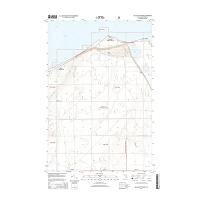
2014 Map of Dollar Settlement
USGS Topo · Published 2014About this map
Dollar Settlement and Raco anchor this coastal landscape along the southern edge of Whitefish Bay. Located within the extensive Hiawatha National Forest, the terrain rises from Lake Superior toward Mission Hill, where local history is preserved at the Mission Hill Cem. The shoreline is defined by notable coastal features such as Nadoway Point and Westons Iroquois Beach, while Point Iroquois stands as a prominent landmark at the eastern edge. Inland, the map reveals a network of water bodies including Monocle Lake and Spectacle Lake, alongside the courses of Little Waiska Cr and S Br Orrs Cr. This survey illustrates the settlement patterns of Chippewa County, where remote outposts are connected by routes like State Hwy 28 and specialized paths like the Frrath Spur. Genealogists will find the locations of Dollar Settlement Cem and Hillcrest Cem essential for tracing local family lineages in this wooded region.
Find a feature on this map
25 named features on this map. Tap any name to fly to it.
Don’t see what you’re looking for? This feature index may not catch every label — zoom into the map to look around manually.
Map Details
Editions of this 2014 Dollar Settlement Map
This is the sole edition of this map. No revisions or reprints were ever made.
Other maps of this area

1941 · Strongs
USGS Topo · 1:63,360

1941 · Brimley
USGS Topo · 1:63,360

1951 · Pendills Lake
USGS Topo · 1:24,000

1951 · Dollar Settlement
USGS Topo · 1:24,000

1951 · Sullivan Creek
USGS Topo · 1:24,000

1951 · Raco
USGS Topo · 1:24,000

1951 · Kinross
USGS Topo · 1:24,000

1951 · Brimley
USGS Topo · 1:62,500

1951 · Strongs
USGS Topo · 1:62,500

1951 · Brimley
USGS Topo · 1:24,000