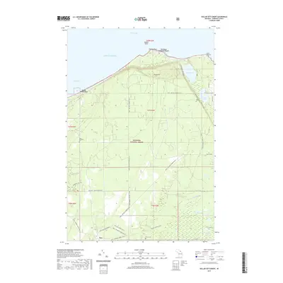
2019 Map of Dollar Settlement
USGS Topo · Published 2019About this map
Whitefish Bay and the cold waters of Lake Superior define the northern edge of this shoreline landscape in the eastern Upper Peninsula. The interior is dominated by the dense woodlands of the Hiawatha National Forest, where a network of recreational and seasonal routes such as the Raco - Bay Mills Snomo and the Waboose Ski trails suggest a modern economy rooted in the outdoors. For local historians, the map preserves the locations of several distinct lakeside communities and resting places, from the namesake Dollar Settlement and its Dollar Settlement Cem in the west to the higher ground of Mission Hill near Point Iroquois in the east.
Find a feature on this map
38 named features on this map. Tap any name to fly to it.
Don’t see what you’re looking for? This feature index may not catch every label — zoom into the map to look around manually.
Map Details
Editions of this 2019 Dollar Settlement Map
This is the sole edition of this map. No revisions or reprints were ever made.
Other maps of this area

1941 · Strongs
USGS Topo · 1:63,360

1941 · Brimley
USGS Topo · 1:63,360

1951 · Pendills Lake
USGS Topo · 1:24,000

1951 · Dollar Settlement
USGS Topo · 1:24,000

1951 · Sullivan Creek
USGS Topo · 1:24,000

1951 · Raco
USGS Topo · 1:24,000

1951 · Kinross
USGS Topo · 1:24,000

1951 · Brimley
USGS Topo · 1:62,500

1951 · Strongs
USGS Topo · 1:62,500

1951 · Brimley
USGS Topo · 1:24,000