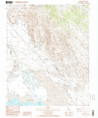
1987 Map of Dolomite
USGS Topo · Published 1987About this map
Industrial history and topographic extremes define the eastern edge of the Owens Valley where the Inyo Mountains meet the northern reaches of Owens Lake. The landscape is marked by the heavy extraction of minerals, evidenced by the numerous Quarries and Borrow Pits concentrated near the settlement of Dolomite. Further south, the Owens Lake Silver-Lead Furnace Historical Marker near Swansea points to the area's mid-19th-century silver mining boom, which relied on these shores for smelting operations.
Find a feature on this map
19 named features on this map. Tap any name to fly to it.
Don’t see what you’re looking for? This feature index may not catch every label — zoom into the map to look around manually.
Map Details
Editions of this 1987 Dolomite Map
3 editions found
Other maps of this area

1905 · Olancha
USGS Topo · 1:125,000

1907 · Olancha
USGS Topo · 1:125,000

1907 · Mt. Whitney
USGS Topo · 1:125,000

1908 · Ballarat
USGS Topo · 1:250,000

1913 · Ballarat
USGS Topo · 1:250,000

1919 · Mt. Whitney
USGS Topo · 1:125,000

1937 · Mt. Whitney
USGS Topo · 1:125,000

1948 · Death Valley
USGS Topo · 1:250,000

1948 · Fresno
USGS Topo · 1:250,000

1950 · New York Butte
USGS Topo · 1:62,500