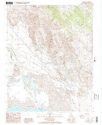
1987 Map of Dolomite
USGS Topo · Published 1987About this map
Owens Lake and its evolving shoreline dominate this landscape on the edge of the Inyo Mountains. The map documents a transition from industrial activity to historical preservation, marked by the Owens Lake Silver-Lead Furnace Historical Marker near Swansea. This area, once a center for silver smelting in the late 19th century, is shown here with its transportation legacy intact via the Old R.R. Grade and a Tramway ascending the steep eastern slopes. The settlement of Dolomite sits along the Levee system that tracks the northeastern edge of the basin. The terrain is characterized by sharp contrasts, where the flat Owens Valley floor meets the alluvial fans of Long John Canyon. Numerous labels for Prospect and Quarry sites throughout the mountains indicate the persistent mineral interest that defined this region's economy.
Find a feature on this map
20 named features on this map. Tap any name to fly to it.
Don’t see what you’re looking for? This feature index may not catch every label — zoom into the map to look around manually.
Map Details
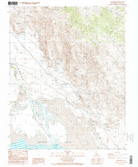
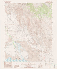
Editions of this 1987 Dolomite Map
3 editions found
Other maps of this area

1905 · Olancha
USGS Topo · 1:125,000

1907 · Olancha
USGS Topo · 1:125,000

1907 · Mt. Whitney
USGS Topo · 1:125,000

1908 · Ballarat
USGS Topo · 1:250,000

1913 · Ballarat
USGS Topo · 1:250,000

1919 · Mt. Whitney
USGS Topo · 1:125,000

1937 · Mt. Whitney
USGS Topo · 1:125,000

1948 · Death Valley
USGS Topo · 1:250,000

1948 · Fresno
USGS Topo · 1:250,000

1950 · New York Butte
USGS Topo · 1:62,500