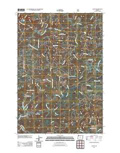
2011 Map of Dolph
USGS Topo · Published 2011About this map
The Little Nestucca River and Salmon River carve through the heavily forested topography of Yamhill County, defining a landscape dominated by timberland and drainage basins. This 2011 survey captures the network of logging and forest service roads that provide access to the interior, such as N Mountain View Rd and N Slick Rock Creek Rd. Key crossings like Yach Bridge, Muscott Bridge, and Weed Bridge highlight the essential infrastructure required to navigate the river valleys. Elevated terrain features like Neskowin Ridge and Saddle Bag Mountain separate the various watersheds, including the Treat River and West Fork Salmon River. A notable landmark within this drainage system is Gunaldo Falls, located along the upper reaches of the Little Nestucca drainage, illustrating the steep gradients of the Oregon coast range.
Find a feature on this map
40 named features on this map. Tap any name to fly to it.
Don’t see what you’re looking for? This feature index may not catch every label — zoom into the map to look around manually.
Map Details
Editions of this 2011 Dolph Map
This is the sole edition of this map. No revisions or reprints were ever made.
Other maps of this area

1941 · Nestucca Bay
USGS Topo · 1:62,500

1942 · Euchre Mtn
USGS Topo · 1:62,500

1942 · Spirit Mtn
USGS Topo · 1:62,500

1942 · Nestucca Bay
USGS Topo · 1:62,500

1942 · Valsetz
USGS Topo · 1:62,500

1943 · Euchre Mtn
USGS Topo · 1:62,500

1948 · Vancouver
USGS Topo · 1:250,000

1950 · Vancouver
USGS Topo · 1:250,000

1950 · Vancouver
USGS Topo · 1:250,000

1953 · Salem
USGS Topo · 1:250,000