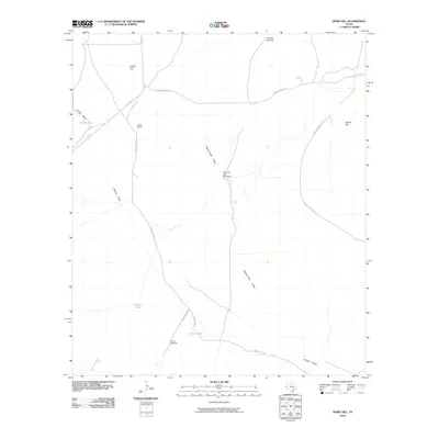
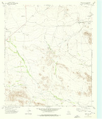
2010 Map of Dome Hill
USGS Topo · Published 2010About this map
Jones Ranch sits at the heart of this Culberson County landscape, a region defined by the water-management infrastructure essential for West Texas ranching. The map documents numerous vital water sources, from windmills like Schilling Windmill and Farrell Windmill to stock tanks such as Luckett Tank and Manuel Tank. These features are connected by a network of ranch roads including Jones-Kent Rd and Elcor-Toyah Rd, which navigate the terrain between Dome Hill and Spring Hill.
Find a feature on this map
17 named features on this map. Tap any name to fly to it.
Don’t see what you’re looking for? This feature index may not catch every label — zoom into the map to look around manually.
Map Details
Editions of this 2010 Dome Hill Map
This is the sole edition of this map. No revisions or reprints were ever made.
Other maps of this area

1906 · Van Horn
USGS Topo · 1:125,000

1928 · Kent
USGS Topo · 1:125,000

1954 · Van Horn
USGS Topo · 1:250,000

1958 · Van Horn
USGS Topo · 1:250,000
1964 · Goat Canyon
USGS Topo · 1:24,000
1970 · East Hunter Canyon
USGS Topo · 1:24,000
1970 · Panther Canyon
USGS Topo · 1:24,000

1972 · Seven Heart Gap
USGS Topo · 1:24,000

1973 · Dellahunt Draw West
USGS Topo · 1:24,000
1973 · Dome Hill
USGS Topo · 1:24,000