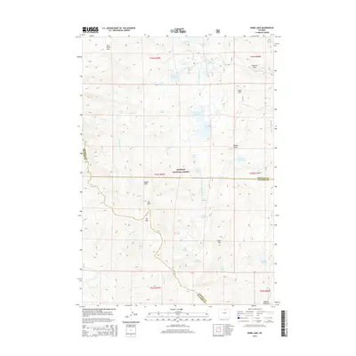
2015 Map of Dome Lake
USGS Topo · Published 2015About this map
The high-altitude terrain of the Bighorn National Forest dominates this topographic survey, revealing a landscape defined by glacial lakes and sharp mountain peaks. Spanning the border of Sheridan and Johnson counties, the area includes prominent landmarks such as Saddle Mtn and Elk Peak, which rise above the surrounding drainages of Porcupine Cr and W Fork Big Goose Cr. The water system is particularly dense, featuring a network of natural and man-made catchments including Dome Lake Reservoir, Sawmill Reservoir, and Lake Fontanalis. High-country transitions are marked by Rock Chuck Pass and Elk Pass, while geological features like Dome Rock and Black Rib indicate the complex batholith structure of the central Bighorn Mountains. This document provides a record of the wilderness hydrology and forest boundaries as they stood in the early 21st century.
Find a feature on this map
49 named features on this map. Tap any name to fly to it.
Don’t see what you’re looking for? This feature index may not catch every label — zoom into the map to look around manually.
Map Details
Editions of this 2015 Dome Lake Map
This is the sole edition of this map. No revisions or reprints were ever made.
Other maps of this area

1895 · Dayton
USGS Topo · 1:125,000

1899 · Cloud peak
USGS Topo · 1:125,000

1901 · Cloud Peak
USGS Topo · 1:125,000

1901 · Dayton
USGS Topo · 1:125,000

1955 · Sheridan
USGS Topo · 1:250,000

1958 · Sheridan
USGS Topo · 1:250,000

1960 · Shell Lake
USGS Topo · 1:24,000

1960 · Spanish Point
USGS Topo · 1:24,000

1962 · Sheridan
USGS Topo · 1:250,000

1964 · Walker Mountain
USGS Topo · 1:24,000