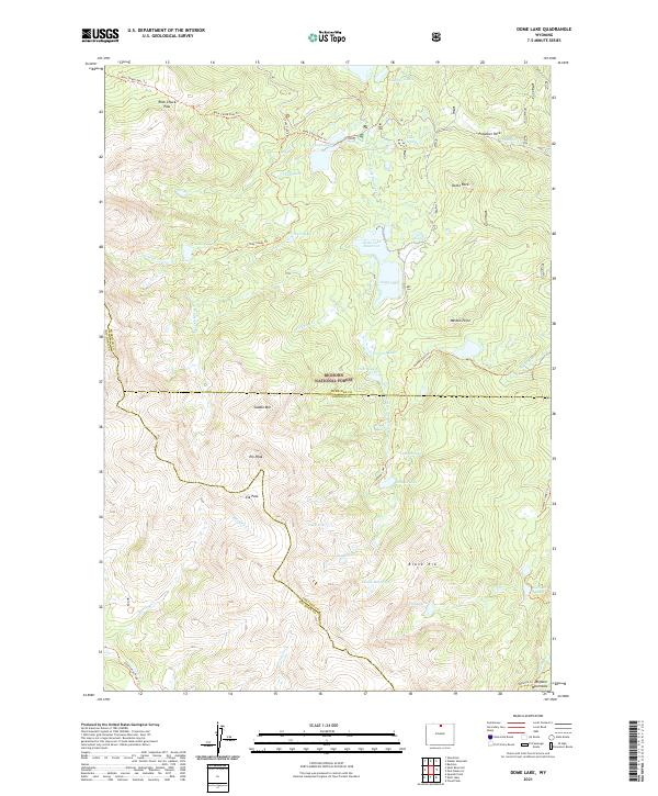
2021 Map of Dome Lake
USGS Topo · Published 2021About this map
The high alpine country of the Bighorn National Forest is defined here by a dense concentration of glacial lakes and dramatic mountain topography. Centered around Dome Lake Reservoir, the landscape is a network of ridges and basins where W Fork Big Goose Cr and Porcupine Cr gather water from numerous small tarns like Heart Lake and Lake Alibi. The terrain is marked by prominent granite features and peaks, including Dome Rock, Elk Peak, and the long ridge of Black Rib.
Find a feature on this map
48 named features on this map. Tap any name to fly to it.
Don’t see what you’re looking for? This feature index may not catch every label — zoom into the map to look around manually.
Map Details
Editions of this 2021 Dome Lake Map
This is the sole edition of this map. No revisions or reprints were ever made.
Other maps of this area

1895 · Dayton
USGS Topo · 1:125,000

1899 · Cloud peak
USGS Topo · 1:125,000

1901 · Cloud Peak
USGS Topo · 1:125,000

1901 · Dayton
USGS Topo · 1:125,000

1955 · Sheridan
USGS Topo · 1:250,000

1958 · Sheridan
USGS Topo · 1:250,000

1960 · Shell Lake
USGS Topo · 1:24,000

1960 · Spanish Point
USGS Topo · 1:24,000

1962 · Sheridan
USGS Topo · 1:250,000

1964 · Walker Mountain
USGS Topo · 1:24,000