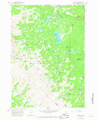
1964 Map of Dome Lake
USGS Topo · Published 1968About this map
Bighorn National Forest dominates this mid-1960s landscape, revealing a high-altitude network of lakes and reservoirs within the Big Horn and Johnson County lines. The topography is defined by significant elevations like Saddle Mountain and Elk Peak, connected by a series of primitive transport routes including a Pack Trail and Jeep Trail. The map documents early recreational infrastructure in the region, featuring the Ranger Creek Campground, Sawmill Lakes Campground, and Twin Lakes Campground.
Find a feature on this map
48 named features on this map. Tap any name to fly to it.
Don’t see what you’re looking for? This feature index may not catch every label — zoom into the map to look around manually.
Map Details
Editions of this 1964 Dome Lake Map
This is the sole edition of this map. No revisions or reprints were ever made.
Other maps of this area

1895 · Dayton
USGS Topo · 1:125,000

1899 · Cloud peak
USGS Topo · 1:125,000

1901 · Cloud Peak
USGS Topo · 1:125,000

1901 · Dayton
USGS Topo · 1:125,000

1955 · Sheridan
USGS Topo · 1:250,000

1958 · Sheridan
USGS Topo · 1:250,000

1960 · Shell Lake
USGS Topo · 1:24,000

1960 · Spanish Point
USGS Topo · 1:24,000

1962 · Sheridan
USGS Topo · 1:250,000

1964 · Walker Mountain
USGS Topo · 1:24,000