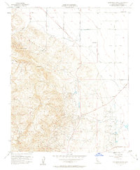
1956 Map of Domengine Ranch
USGS Topo · Published 1963About this map
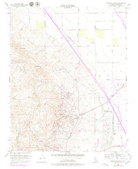
The Coalinga Oil Field and the East Coalinga Extension Oil Field dominate the rugged southeastern terrain of this Fresno County landscape. During the mid-1950s, the region was defined by this industrial footprint alongside traditional livestock operations at Domengine Ranch and Jordan Ranch. To the northwest, the Big Blue Hills rise sharply, dissected by drainages like Martinez Creek, while the northeastern plains are gridded by an orderly system of named avenues including Stanislaus Avenue and Jeffrey Avenue. The infrastructure of water management is clearly visible through the Tuolumne Canal and Salt Creek Canal, which supported both agriculture and industrial needs. Notable local landmarks such as the Mack Pumping Sta and the settlement of Domengine provide specific points of interest for those tracing the history of California's Central Valley petroleum and ranching heritage.
Find a feature on this map
25 named features on this map. Tap any name to fly to it.
Don’t see what you’re looking for? This feature index may not catch every label — zoom into the map to look around manually.
Map Details
Editions of this 1956 Domengine Ranch Map
7 editions found
Other maps of this area

1912 · Coalinga
USGS Topo · 1:125,000

1928 · Delta Farms No 3
USGS Topo · 1:31,680

1931 · Towne Oil Station
USGS Topo · 1:31,680

1931 · Mouth of Cantua Creek
USGS Topo · 1:31,680

1932 · Delta Farms
USGS Topo · 1:31,680

1933 · Guijarral Hills
USGS Topo · 1:31,680
1936 · Guijarral Hills
USGS Topo · 1:31,680
1937 · Guijarral Hills
USGS Topo · 1:31,680
1942 · Polvadero Gap
USGS Topo · 1:62,500

1943 · Joaquin Rocks
USGS Topo · 1:62,500