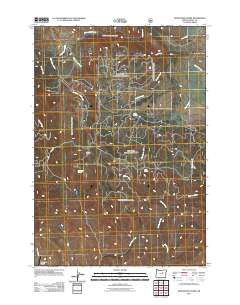
2011 Map of Donaldson Creek
USGS Topo · Published 2011About this map
Wiley Creek Airport serves as a remote landmark in this high-altitude landscape of Grant County, Oregon, where the terrain is defined by a dense network of forest service roads and riparian corridors. The drainage patterns of the Blue Mountains are clearly visible, with the headwaters of Donaldson Creek and Boulder Creek cutting through the topography. These seasonal and perennial waters are complemented by essential livestock or wildlife watering points such as Sagebrush Spring and Dolly Spring.
Find a feature on this map
18 named features on this map. Tap any name to fly to it.
Don’t see what you’re looking for? This feature index may not catch every label — zoom into the map to look around manually.
Map Details
Editions of this 2011 Donaldson Creek Map
This is the sole edition of this map. No revisions or reprints were ever made.
Other maps of this area

1940 · Mount Vernon
USGS Topo · 1:62,500

1940 · Aldrich Mtn.
USGS Topo · 1:62,500

1943 · Aldrich Mtn.
USGS Topo · 1:62,500

1943 · Mount Vernon
USGS Topo · 1:62,500

1949 · Long Creek
USGS Topo · 1:62,500

1951 · Long Creek
USGS Topo · 1:62,500

1951 · Courtrock
USGS Topo · 1:62,500

1955 · Canyon City
USGS Topo · 1:250,000

1959 · Canyon City
USGS Topo · 1:250,000
1972 · Aldrich Mountain North
USGS Topo · 1:24,000