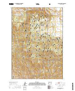
2020 Map of Donaldson Creek
USGS Topo · Published 2020About this map
The high-elevation terrain of Malheur National Forest dominates this Grant County landscape, characterized by a dense network of water sources and narrow drainages. The map reveals a transition from the lower elevations of Fox Valley in the northeast toward more complex topography to the south and west. Significant water features include Cottonwood Cr and Donaldson Cr, which are fed by numerous named springs such as Hinton Spring, Willow Spring, and Sagebrush Spring. These points of water access were historically critical for land management and livestock in this part of Oregon. In the southwest corner, the Wiley Creek Airport sits near the banks of Wiley Cr, providing a localized point of modern infrastructure amidst the surrounding wilderness areas like Shop Gulch and Wildcat Cr.
Find a feature on this map
24 named features on this map. Tap any name to fly to it.
Don’t see what you’re looking for? This feature index may not catch every label — zoom into the map to look around manually.
Map Details
Editions of this 2020 Donaldson Creek Map
This is the sole edition of this map. No revisions or reprints were ever made.
Other maps of this area

1940 · Mount Vernon
USGS Topo · 1:62,500

1940 · Aldrich Mtn.
USGS Topo · 1:62,500

1943 · Aldrich Mtn.
USGS Topo · 1:62,500

1943 · Mount Vernon
USGS Topo · 1:62,500

1949 · Long Creek
USGS Topo · 1:62,500

1951 · Long Creek
USGS Topo · 1:62,500

1951 · Courtrock
USGS Topo · 1:62,500

1955 · Canyon City
USGS Topo · 1:250,000

1959 · Canyon City
USGS Topo · 1:250,000
1972 · Aldrich Mountain North
USGS Topo · 1:24,000