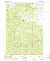
1990 Map of Donaldson Creek
USGS Topo · Published 1990About this map
Malheur National Forest dominates the interior of this topographic study, revealing a landscape defined by an intricate network of drainages and seasonal water sources. The presence of Pismire Camp (Site) suggests a history of temporary habitation or forestry management in the area, while a Gravel Pit near the center of the map indicates localized resource extraction. To the northeast, the terrain opens into Fox Valley, where the confluence of Fox Creek and its tributaries like Slip Up Cr and Beck Creek create a distinct geographic transition. Numerous named springs, such as Sagebrush Spring, Hinton Spring, and Dolly Spring, are critical landmarks across the high country, providing a detailed look at the hydrology supporting this portion of Grant County during the late twentieth century.
Find a feature on this map
23 named features on this map. Tap any name to fly to it.
Don’t see what you’re looking for? This feature index may not catch every label — zoom into the map to look around manually.
Map Details
Editions of this 1990 Donaldson Creek Map
This is the sole edition of this map. No revisions or reprints were ever made.
Other maps of this area

1940 · Mount Vernon
USGS Topo · 1:62,500

1940 · Aldrich Mtn.
USGS Topo · 1:62,500

1943 · Aldrich Mtn.
USGS Topo · 1:62,500

1943 · Mount Vernon
USGS Topo · 1:62,500

1949 · Long Creek
USGS Topo · 1:62,500

1951 · Long Creek
USGS Topo · 1:62,500

1951 · Courtrock
USGS Topo · 1:62,500

1955 · Canyon City
USGS Topo · 1:250,000

1959 · Canyon City
USGS Topo · 1:250,000
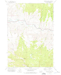
1972 · Aldrich Mountain North
USGS Topo · 1:24,000