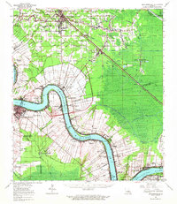
1962 Map of Donaldsonville
USGS Topo · Published 1963About this map
The Mississippi River creates a deep, winding corridor through this section of Louisiana, anchoring the historic river parishes of Ascension, St. James, and Assumption. During the early 1960s, the landscape was a complex mosaic of sugarcane-producing settlements like Lemannville, Welcome, and Romeville clustered along the high ground of the river's levees. Inland, the rising terrain of McElroy Ridge and Lake Ridge transitions into the swampy lowlands of the Blind River and Amite River basins.
Find a feature on this map
118 named features on this map. Tap any name to fly to it.
Don’t see what you’re looking for? This feature index may not catch every label — zoom into the map to look around manually.
Map Details
Editions of this 1962 Donaldsonville Map
This is the sole edition of this map. No revisions or reprints were ever made.
Other maps of this area

1892 · Lac Des Allemands
USGS Topo · 1:62,500

1892 · Mount Airy
USGS Topo · 1:62,500

1892 · Donaldsonville
USGS Topo · 1:62,500

1892 · Thibodaux
USGS Topo · 1:62,500

1908 · Baton Rouge
USGS Topo · 1:62,500

1927 · Thibodaux NW
USGS Topo · 1:31,680

1932 · Lac Des Allemands NW
USGS Topo · 1:31,680

1932 · Thibodaux NE
USGS Topo · 1:31,680

1934 · Denham Springs
USGS Topo · 1:62,500

1934 · Springfield
USGS Topo · 1:62,500