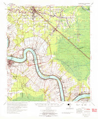
1965 Map of Donaldsonville
USGS Topo · Published 1965About this map
The Mississippi River winds through this mid-1960s survey, anchoring a landscape of historic plantation tracts and expanding oil industry. The river’s deep meander at Bringier Point and Point Houmas is lined with named properties such as Belle Helene Plantation, Monroe Plantation, and the Uncle Sam Plantation, reflecting the long-standing land divisions of St James Parish and Ascension Parish. Inland from the river, the settlement of Gonzales shows significant growth near Bayou Narcisse, while the petroleum economy is evident in the Darrow Oil Field and the Sorrento Gas and Oil Field. The Illinois Central and Kansas City Southern railroads provide critical transport links through the lowlands, passing by rural centers like Sorrento and St Amant. Local history is preserved in numerous church and cemetery sites, including St Landry Ch Cem and the combined St Michael Sch & St Michael Cem near Convent.
Find a feature on this map
118 named features on this map. Tap any name to fly to it.
Don’t see what you’re looking for? This feature index may not catch every label — zoom into the map to look around manually.
Map Details
Editions of this 1965 Donaldsonville Map
This is the sole edition of this map. No revisions or reprints were ever made.
Other maps of this area

1892 · Lac Des Allemands
USGS Topo · 1:62,500

1892 · Mount Airy
USGS Topo · 1:62,500

1892 · Donaldsonville
USGS Topo · 1:62,500

1892 · Thibodaux
USGS Topo · 1:62,500

1908 · Baton Rouge
USGS Topo · 1:62,500

1927 · Thibodaux NW
USGS Topo · 1:31,680

1932 · Lac Des Allemands NW
USGS Topo · 1:31,680

1932 · Thibodaux NE
USGS Topo · 1:31,680

1934 · Denham Springs
USGS Topo · 1:62,500

1934 · Springfield
USGS Topo · 1:62,500