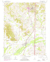
1966 Map of Dongola
USGS Topo · Published 1978About this map
The Illinois Central Gulf railroad serves as the primary spine for settlement in this portion of Southern Illinois, connecting the villages of Dongola, Wetaug, and Ullin. Located near the convergence of Union, Pulaski, and Alexander Counties, the landscape is defined by the winding course of the Cache River and its numerous tributaries like Indian Camp Creek and Crooked Creek. A significant portion of the western terrain is protected within the Shawnee National Forest, where the topography rises toward Rattlesnake Hill.
Find a feature on this map
32 named features on this map. Tap any name to fly to it.
Don’t see what you’re looking for? This feature index may not catch every label — zoom into the map to look around manually.
Map Details
Editions of this 1966 Dongola Map
3 editions found
Other maps of this area

1920 · Jonesboro
USGS Topo · 1:62,500

1920 · Dongola
USGS Topo · 1:62,500

1923 · Dongola
USGS Topo · 1:62,500

1923 · Jonesboro
USGS Topo · 1:62,500

1931 · Cairo
USGS Topo · 1:62,500

1933 · Cairo
USGS Topo · 1:62,500

1934 · Thebes
USGS Topo · 1:62,500

1939 · Cairo
USGS Topo · 1:62,500

1939 · Thebes
USGS Topo · 1:62,500

1947 · Jonesboro
USGS Topo · 1:62,500