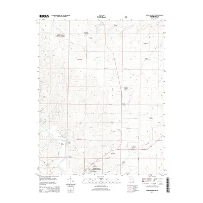
2015 Map of Doniphan North
USGS Topo · Published 2015About this map
Current River flows through the southwestern corner of this Ripley County landscape, defining the topography near Schoolhouse Bay and Spring Bay. The area is characterized by a dense network of cemeteries and small settlements, such as Pleasant Grove and Hill Top, which point to the deep-rooted local history of this portion of the Mark Twain National Forest. The eastern portion of the map is drained by the S Prong Little Black River and its various tributaries like Flat Cr. Genealogists will find a significant number of burial sites, including the Emmons Cemetery, Elizabeth Cemetery, and Saint Benedicts Cemetery. Transportation and infrastructure are represented by the Doniphan Municipal Airport and a grid of rural routes including State Hwy Y and Mo-K, which connect the scattered communities across this Ozark foothills terrain.
Find a feature on this map
77 named features on this map. Tap any name to fly to it.
Don’t see what you’re looking for? This feature index may not catch every label — zoom into the map to look around manually.
Map Details
Editions of this 2015 Doniphan North Map
This is the sole edition of this map. No revisions or reprints were ever made.
Other maps of this area

1934 · Williamsville
USGS Topo · 1:48,000

1935 · Acorn
USGS Topo · 1:62,500

1939 · Doniphan
USGS Topo · 1:62,500

1940 · Williamsville
USGS Topo · 1:62,500

1940 · Naylor
USGS Topo · 1:62,500

1944 · Naylor
USGS Topo · 1:62,500

1944 · Grandin
USGS Topo · 1:62,500

1945 · Doniphan
USGS Topo · 1:62,500

1946 · Grandin
USGS Topo · 1:62,500

1957 · Poplar Bluff
USGS Topo · 1:250,000