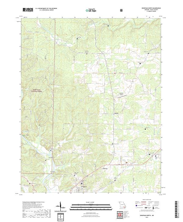
2021 Map of Doniphan North
USGS Topo · Published 2021About this map
Doniphan sits at the southern edge of this Missouri Ozarks terrain, where the Current River flows past the bluffs of t23n r2e. The landscape is a network of ridges and river bends, including prominent features like Pine Bluff and Cedar Bluff. The area north of the town is dotted with small family and community burial grounds, such as Saint Benedict Cem and Hunt - White Memorial Gardens, reflecting a deeply rooted settlement pattern.
Find a feature on this map
71 named features on this map. Tap any name to fly to it.
Don’t see what you’re looking for? This feature index may not catch every label — zoom into the map to look around manually.
Map Details
Editions of this 2021 Doniphan North Map
This is the sole edition of this map. No revisions or reprints were ever made.
Other maps of this area

1934 · Williamsville
USGS Topo · 1:48,000

1935 · Acorn
USGS Topo · 1:62,500

1939 · Doniphan
USGS Topo · 1:62,500

1940 · Williamsville
USGS Topo · 1:62,500

1940 · Naylor
USGS Topo · 1:62,500

1944 · Naylor
USGS Topo · 1:62,500

1944 · Grandin
USGS Topo · 1:62,500

1945 · Doniphan
USGS Topo · 1:62,500

1946 · Grandin
USGS Topo · 1:62,500

1957 · Poplar Bluff
USGS Topo · 1:250,000