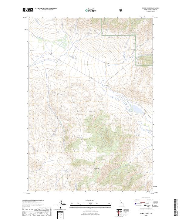
2023 Map of Donkey Creek
USGS Topo · Published 2023About this map
The Lemhi Range dominates the eastern landscape of this high-elevation Idaho interior, where the Challis National Forest boundary meets the rugged drainages of the Pahsimeroi Valley. This 2023 survey documents a remote watershed defined by seasonal flow and the prominence of the Donkey Hills to the south. Water is the primary architect of the terrain here, as evidenced by the convergence of Donkey Creek, Summit Creek, and Goldburg Creek. Human presence is minimal and primarily infrastructure-based, centered on the corridor of Pahsimeroi Rd and Goldburg Rd. These routes connect isolated landmarks like Groves Spring and traverse steep topography through Big Gulch. The map provides a contemporary record of land management and hydrologic patterns within the T11N and T12N township lines.
Find a feature on this map
21 named features on this map. Tap any name to fly to it.
Don’t see what you’re looking for? This feature index may not catch every label — zoom into the map to look around manually.
Map Details
Editions of this 2023 Donkey Creek Map
This is the sole edition of this map. No revisions or reprints were ever made.
Other maps of this area

1935 · Borah Peak
USGS Topo · 1:125,000

1938 · Borah Peak
USGS Topo · 1:125,000

1955 · Dubois
USGS Topo · 1:250,000

1956 · Donkey Hills
USGS Topo · 1:62,500

1957 · Gilmore
USGS Topo · 1:62,500

1957 · Hawley Mountain
USGS Topo · 1:62,500

1958 · Dubois
USGS Topo · 1:250,000
1967 · Burnt Creek
USGS Topo · 1:24,000
1967 · Short Creek
USGS Topo · 1:24,000
1987 · Red Hills
USGS Topo · 1:24,000