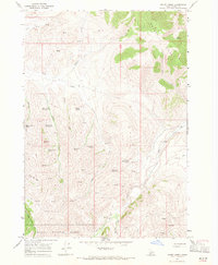
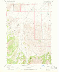
1967 Map of Short Creek
USGS Topo · Published 1971About this map
Challis National Forest land defines this Idaho landscape, characterized by high-elevation terrain where water sources are the primary landmarks. In the late 1960s, these slopes were mapped with a focus on seasonal hydrologic features, including a dense concentration of named springs such as Short Creek Spring No 1, Middle Spring, and Baby Creek Spring. The presence of several Corrals and a Water Tank near Dry Creek suggests seasonal grazing activity common in the Intermountain West during this era. High ridges and peaks like Garrett Rock, Squawtip, and the Rock of Ages dominate the central and southern portions of the quadrangle. Transport across the Donkey Hills and surrounding valleys relied on an established network of primitive routes, including a Jeep Trail, Pack Trail, and various other Trails that likely served local ranchers and early recreationalists.
Find a feature on this map
34 named features on this map. Tap any name to fly to it.
Don’t see what you’re looking for? This feature index may not catch every label — zoom into the map to look around manually.
Map Details
Editions of this 1967 Short Creek Map
2 editions found
Other maps of this area

1935 · Borah Peak
USGS Topo · 1:125,000

1938 · Borah Peak
USGS Topo · 1:125,000

1955 · Dubois
USGS Topo · 1:250,000

1956 · Donkey Hills
USGS Topo · 1:62,500

1957 · Gilmore
USGS Topo · 1:62,500

1957 · Hawley Mountain
USGS Topo · 1:62,500

1958 · Dubois
USGS Topo · 1:250,000
1962 · Leatherman Peak
USGS Topo · 1:24,000
1967 · Massacre Mtn
USGS Topo · 1:24,000
1967 · Burnt Creek
USGS Topo · 1:24,000