
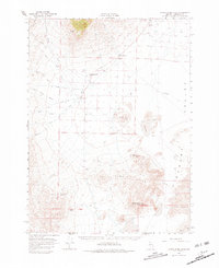
1966 Map of Donna Schee Peak
USGS Topo · Published 1968About this map
Alexander Ranch and Willow Creek Ranch anchor the northern reaches of this mid-1960s survey, illustrating the vital role of water management in the high desert. A network of irrigation channels, including Ditch 17 through Ditch 20, cuts across the terrain to support agriculture near Trout Creek Ranch. This focus on water access is further evidenced by isolated outposts like Fivemile Well and the Mc Ninch Well, which provided essential resources for both livestock and early travelers navigating the arid landscape.
Find a feature on this map
40 named features on this map. Tap any name to fly to it.
Don’t see what you’re looking for? This feature index may not catch every label — zoom into the map to look around manually.
Map Details
Editions of this 1966 Donna Schee Peak Map
2 editions found
Other maps of this area

1886 · Disaster
USGS Topo · 1:250,000

1893 · Disaster
USGS Topo · 1:250,000

1931 · Lovelock
USGS Topo · 1:250,000

1935 · Lovelock
USGS Topo · 1:250,000

1954 · Vya
USGS Topo · 1:250,000

1955 · Lovelock
USGS Topo · 1:250,000

1958 · Vya
USGS Topo · 1:250,000

1959 · Lovelock
USGS Topo · 1:250,000

1961 · Bottle Creek
USGS Topo · 1:62,500

1962 · Vya
USGS Topo · 1:250,000