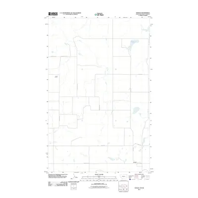
2011 Map of Dooley
USGS Topo · Published 2011About this map
The settlement of Dooley stands at the southern edge of this High Plains landscape, situated along the border of Montana and Saskatchewan. The terrain is characterized by a network of drainage features and depressions, most notably the seasonal waters of Johnson Lake and Brightsmen Lake in the northeast. Further west, the winding path of Outlaw Coulee cuts through the plains, mirrored by the route of Outlaw Coulee Rd. This 2011 survey by the U.S. Geological Survey captures a sparsely populated region where a grid of rural roads, including North Ridge Rd and Salt Lake Rd, connects isolated sites. Genealogists may find particular interest in the Wankel Cemetery, which serves as a significant historical marker for the families who settled this northern frontier near the Canadian border.
Find a feature on this map
11 named features on this map. Tap any name to fly to it.
Don’t see what you’re looking for? This feature index may not catch every label — zoom into the map to look around manually.
Map Details
Editions of this 2011 Dooley Map
This is the sole edition of this map. No revisions or reprints were ever made.
Other maps of this area

1954 · Wolf Point
USGS Topo · 1:250,000

1958 · Wolf Point
USGS Topo · 1:250,000

1983 · Dooley
USGS Topo · 1:24,000

1983 · Dooley SW
USGS Topo · 1:24,000

1983 · Dooley SE
USGS Topo · 1:24,000

1983 · Park Lake
USGS Topo · 1:24,000

1983 · Plentywood
USGS Topo · 1:24,000

1983 · Raymond
USGS Topo · 1:24,000
2011 · Dooley SW
USGS Topo · 1:24,000
2011 · Plentywood
USGS Topo · 1:24,000