
1971 Map of Doon
USGS Topo · Published 1973About this map
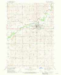
Doon serves as the primary hub of activity in this northwest Iowa landscape, situated at the confluence of the Rock River and the Little Rock River. The town's grid is bisected by the Burlington Northern railroad, reflecting the vital transport corridors of the early 1970s. Industrial and infrastructure markers, such as the local Water Tank, Sewage Disposal Ponds, and several active Gravel Pit sites, provide a detailed look at the local economy and land use during this era.
Find a feature on this map
13 named features on this map. Tap any name to fly to it.
Don’t see what you’re looking for? This feature index may not catch every label — zoom into the map to look around manually.
Map Details
Editions of this 1971 Doon Map
This is the sole edition of this map. No revisions or reprints were ever made.
Other maps of this area

1955 · Sioux Falls
USGS Topo · 1:250,000

1958 · Sioux Falls
USGS Topo · 1:250,000

1964 · Boyden
USGS Topo · 1:24,000

1964 · Hull
USGS Topo · 1:24,000
1968 · Rock Valley
USGS Topo · 1:24,000

1971 · Edna
USGS Topo · 1:24,000

1971 · Lester
USGS Topo · 1:24,000

1971 · George West
USGS Topo · 1:24,000

1971 · Rock Rapids
USGS Topo · 1:24,000
1971 · Alvord
USGS Topo · 1:24,000