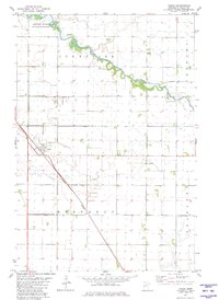
1981 Map of Doran
USGS Topo · Published 1981About this map
The settlement of Doran sits at the heart of this Wilkin County landscape, where the agricultural plains of western Minnesota are defined by a sophisticated network of water management. The meandering path of the Otter Tail River winds through the northern sections of Sunnyside, providing a sharp contrast to the straight, engineered lines of County Ditch No 35 and State Ditch No 17 that drain the fertile farmland.
Find a feature on this map
13 named features on this map. Tap any name to fly to it.
Don’t see what you’re looking for? This feature index may not catch every label — zoom into the map to look around manually.
Map Details
Editions of this 1981 Doran Map
This is the sole edition of this map. No revisions or reprints were ever made.
Other maps of this area

1904 · Wahpeton
USGS Topo · 1:125,000

1919 · Rothsay
USGS Topo · 1:62,500

1951 · Rothsay
USGS Topo · 1:62,500

1951 · Campbell
USGS Topo · 1:62,500

1953 · Fargo
USGS Topo · 1:250,000

1956 · Fargo
USGS Topo · 1:250,000

1964 · Wahpeton
USGS Topo · 1:24,000
1973 · South of Wahpeton
USGS Topo · 1:24,000
1973 · Fairmount
USGS Topo · 1:24,000
1981 · Campbell
USGS Topo · 1:24,000