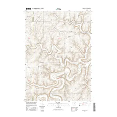
2015 Map of Dorchester
USGS Topo · Published 2015About this map
Quandahl and Dorchester anchor this 2015 study of the driftless landscape along the border of Winneshiek and Allamakee Counties. The area is defined by the winding course of the Upper Iowa River and its many tributaries, including Waterloo Creek, Bear Creek, and Paint Creek. This river system creates a deeply carved topography, where roads like Iverson Bridge Road and Ellingson Bridge Drive suggest the critical crossing points that have historically connected these isolated valley communities.
Find a feature on this map
62 named features on this map. Tap any name to fly to it.
Don’t see what you’re looking for? This feature index may not catch every label — zoom into the map to look around manually.
Map Details
Editions of this 2015 Dorchester Map
This is the sole edition of this map. No revisions or reprints were ever made.
Other maps of this area

1903 · Waukon
USGS Topo · 1:125,000

1906 · Decorah
USGS Topo · 1:125,000

1956 · Brownsville
USGS Topo · 1:62,500

1958 · La Crosse
USGS Topo · 1:250,000

1961 · La Crosse
USGS Topo · 1:250,000

1965 · La Crosse
USGS Topo · 1:250,000

1965 · Wilmington
USGS Topo · 1:24,000

1965 · Spring Grove
USGS Topo · 1:24,000

1968 · Waukon
USGS Topo · 1:24,000
1968 · Waukon NW
USGS Topo · 1:24,000