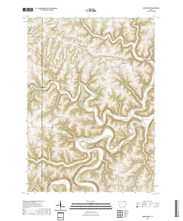
2022 Map of Dorchester
USGS Topo · Published 2022About this map
Upper Iowa River and its intricate tributaries dominate this corner of Allamakee County, where the driftless landscape creates deeply carved valleys and sharp ridges. The settlement of Dorchester sits at a critical juncture where Waterloo Cr meets the main river valley, while the smaller community of Quandahl is positioned further west along Bear Creek. The map is particularly valuable for genealogical research, documenting numerous rural burying grounds that speak to the area's pioneer heritage, including the Swenson Farm Cem, O'Hare Place Cem, and the dual sites of Saint Johns Methodist Cem and Saint Marys Cem. A complex network of gravel and paved roads like Co Hwy W40 and Dorchester Rd trace the ridgelines and valley floors, illustrating how the topography has historically dictated movement and settlement patterns in this northeastern Iowa borderland.
Find a feature on this map
67 named features on this map. Tap any name to fly to it.
Don’t see what you’re looking for? This feature index may not catch every label — zoom into the map to look around manually.
Map Details
Editions of this 2022 Dorchester Map
This is the sole edition of this map. No revisions or reprints were ever made.
Other maps of this area

1903 · Waukon
USGS Topo · 1:125,000

1906 · Decorah
USGS Topo · 1:125,000

1956 · Brownsville
USGS Topo · 1:62,500

1958 · La Crosse
USGS Topo · 1:250,000

1961 · La Crosse
USGS Topo · 1:250,000

1965 · La Crosse
USGS Topo · 1:250,000

1965 · Wilmington
USGS Topo · 1:24,000

1965 · Spring Grove
USGS Topo · 1:24,000

1968 · Waukon
USGS Topo · 1:24,000
1968 · Waukon NW
USGS Topo · 1:24,000