Loading...
Loading map...1940 Map of Dorchester
USGS Topo · Published 1950About this map
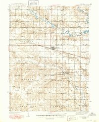
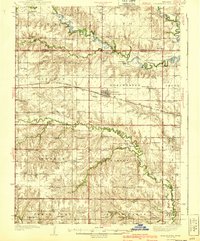
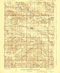
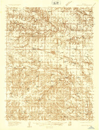
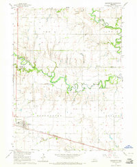
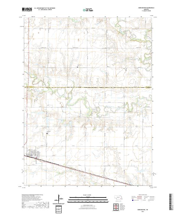
Dorchester serves as the central hub of this Nebraska landscape, where the Chicago Burlington and Quincy railroad cuts a diagonal line across the prairie. The terrain is defined by the winding course of the Big Blue River and its West Fork Big Blue River, with several dams noted along their lengths. The map reveals an exceptionally dense network of rural infrastructure typical of the pre-war era, characterized by a one-room schoolhouse nearly every few miles.
Find a feature on this map
82 named features on this map. Tap any name to fly to it.
Don’t see what you’re looking for? This feature index may not catch every label — zoom into the map to look around manually.
Map Details
Date Portrayed1940
Date Published1950
PublisherU.S. Geological Survey
Map TypeTopographic
Scale1:62,500
Physical Dimensions16.9 x 20.8 inches
Editions of this 1940 Dorchester Map
3 editions found
Historical Maps of Dorchester Through Time
7 maps found
Featured Locations
Source Details
SourceU.S. Geological Survey
CopyrightPublic Domain