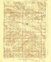
1940 Map of Dorchester
USGS Topo · Published 1940About this map
The Chicago Burlington and Quincy railroad cuts a straight path across this Saline County landscape, anchoring the town of Dorchester. This 1935 survey captures a densely settled rural network during the mid-Depression era, characterized by a nearly uniform grid of section-line roads and an extraordinary density of country schoolhouses. Educational landmarks such as Mayflower Sch, Rosedale Sch, and Evergreen Sch appear every few miles, serving the farm families of townships like Monroe and Pleasant Hill.
Find a feature on this map
73 named features on this map. Tap any name to fly to it.
Don’t see what you’re looking for? This feature index may not catch every label — zoom into the map to look around manually.
Map Details
Editions of this 1940 Dorchester Map
3 editions found
Other maps of this area

1897 · Lincoln
USGS Topo · 1:125,000

1934 · Seward
USGS Topo · 1:48,000

1934 · Utica
USGS Topo · 1:62,500

1935 · Dorchester
USGS Topo · 1:48,000

1937 · Utica
USGS Topo · 1:62,500

1939 · Seward
USGS Topo · 1:62,500

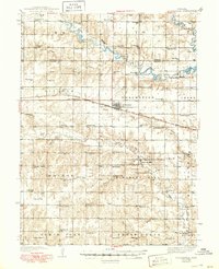
1940 · Dorchester
USGS Topo · 1:62,500

1955 · Lincoln
USGS Topo · 1:250,000

1957 · Lincoln
USGS Topo · 1:250,000

1957 · Wilber
USGS Topo · 1:24,000