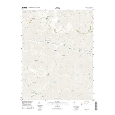
2014 Map of Dorothy
USGS Topo · Published 2014About this map
The coal-rich mountains of the Kanawha and Raleigh County border define this West Virginia landscape, centered on the company towns and hamlets that followed the narrow creek valleys. Along the Clear Fork, the interconnected communities of Dorothy, Colcord, and Ameagle show a pattern of settlement constrained by the steep slopes of Kayford Mtn and Coal River Mtn. Local family history is preserved in numerous upland burial sites, including Stanley Cem and Estep Bailey Cem, often located on ridges above the mines.
Find a feature on this map
88 named features on this map. Tap any name to fly to it.
Don’t see what you’re looking for? This feature index may not catch every label — zoom into the map to look around manually.
Map Details
Editions of this 2014 Dorothy Map
This is the sole edition of this map. No revisions or reprints were ever made.
Other maps of this area

1891 · Oceana
USGS Topo · 1:125,000

1891 · Raleigh
USGS Topo · 1:125,000

1893 · Oceana
USGS Topo · 1:125,000

1897 · Kanawha Falls
USGS Topo · 1:125,000

1897 · Raleigh
USGS Topo · 1:125,000

1898 · Oceana
USGS Topo · 1:125,000

1899 · Charleston
USGS Topo · 1:125,000

1900 · Kanawha Falls
USGS Topo · 1:125,000

1901 · Kanawha Falls
USGS Topo · 1:125,000

1902 · Raleigh
USGS Topo · 1:125,000