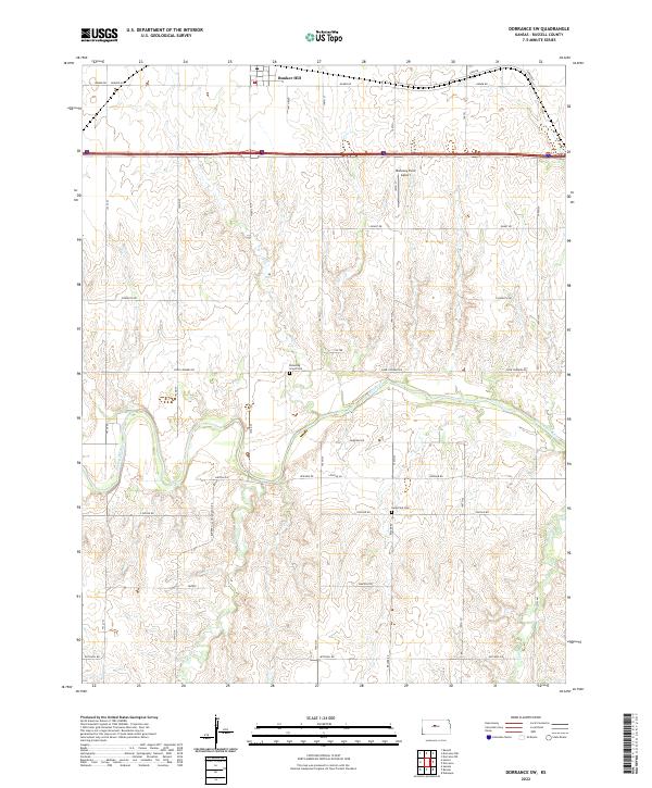
2022 Map of Dorrance SW
USGS Topo · Published 2022About this map
Bunker Hill sits at the northern edge of this Russell County landscape, where the flat upland plains begin their descent toward the winding course of the Smoky Hill River. The river bisects the territory from west to east, creating a distinct riparian corridor that contrasts with the surrounding agricultural sections. For genealogists and local historians, the map preserves the location of rural burial grounds including Blooming Grove Cem near the river and Hyde Park Cem further south. The land is defined by a rigid grid of section roads like Lincoln Rd and Four Corners Rd, which follow the Public Land Survey System boundaries. A mix of natural drainages, such as Beaver Cr and Goose Cr, feed into the river valley, while modern infrastructure is represented by the Mahoney Farm Airport and the major east-west corridor of Interstate 70.
Find a feature on this map
37 named features on this map. Tap any name to fly to it.
Don’t see what you’re looking for? This feature index may not catch every label — zoom into the map to look around manually.
Map Details
Editions of this 2022 Dorrance SW Map
This is the sole edition of this map. No revisions or reprints were ever made.
Other maps of this area

1896 · Russell
USGS Topo · 1:125,000

1955 · Great Bend
USGS Topo · 1:250,000

1956 · Dorrance
USGS Topo · 1:24,000

1956 · Dorrance SW
USGS Topo · 1:24,000

1957 · Great Bend
USGS Topo · 1:250,000

1958 · Great Bend
USGS Topo · 1:250,000

1961 · Homer
USGS Topo · 1:24,000
1967 · Dorrance NW
USGS Topo · 1:24,000

1967 · Russell
USGS Topo · 1:24,000
1967 · Dorrance NE
USGS Topo · 1:24,000