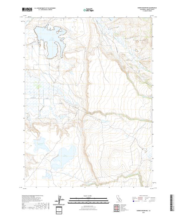
2021 Map of Dorris Reservoir
USGS Topo · Published 2021About this map
Dorris Reservoir anchors this high-desert water management landscape in the shadows of the Warner Mountains. The terrain is defined by a sophisticated network of catchment and storage, where numerous smaller basins such as Dannhauser Reservoir, Payne Reservoir, and French Reservoir dot the valley floor. These reservoirs are fed by a series of seasonal drainages, including Pine Cr and Fitzhugh Cr, which descend from the more dramatic topography of the eastern peaks. To the northeast, the land rises into the complex drainage systems of Renfro Canyon and White Horse Canyon. This USGS study reveals the contemporary infrastructure of Modoc County, showcasing how modern ranching and conservation efforts rely on these dispersed water sources. The map also delineates the extensive rural road network, including Pine Creek Blvd and Parker Creek Rd, which provide access across the township and range grids.
Find a feature on this map
32 named features on this map. Tap any name to fly to it.
Don’t see what you’re looking for? This feature index may not catch every label — zoom into the map to look around manually.
Map Details
Editions of this 2021 Dorris Reservoir Map
This is the sole edition of this map. No revisions or reprints were ever made.
Other maps of this area

1886 · Alturas
USGS Topo · 1:250,000

1892 · Alturas
USGS Topo · 1:250,000

1954 · Alturas
USGS Topo · 1:250,000

1958 · Alturas
USGS Topo · 1:250,000

1961 · Alturas
USGS Topo · 1:62,500

1962 · Alturas
USGS Topo · 1:250,000

1962 · Davis Creek
USGS Topo · 1:62,500

1962 · Big Sage Reservoir
USGS Topo · 1:62,500

1963 · Little Juniper Reservoir
USGS Topo · 1:24,000

1963 · Shields Creek
USGS Topo · 1:24,000