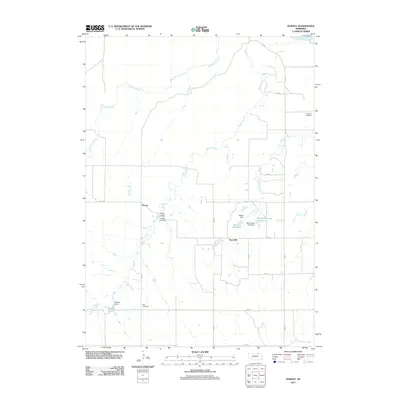
2011 Map of Dorsey
USGS Topo · Published 2011About this map
Steel Creek and Pishel Creek carve their way through the Holt County landscape toward the Niobrara River in this 2011 topographic study. The rural settlement of Dorsey serves as a central point in an area defined by small-scale water management and historical burial grounds. Notable landmarks include the Bartos Reservoir Number 2 and Revell Ponds, reflecting a reliance on local dams to manage the drainage of Red Otter Creek across these northern plains. Genealogists will find several significant sites, specifically the Dorsey Cemetery near Long Gulch, the Star Cemetery to the south, and the National Cemetery located in the northeastern quadrant. The grid of rural roads, such as 512 Ave and 887 Rd, connects these scattered sites with the community of Knoxville, illustrating the persistent and sparse settlement patterns of the region.
Find a feature on this map
28 named features on this map. Tap any name to fly to it.
Don’t see what you’re looking for? This feature index may not catch every label — zoom into the map to look around manually.
Map Details
Editions of this 2011 Dorsey Map
This is the sole edition of this map. No revisions or reprints were ever made.
Other maps of this area

1950 · Verdel
USGS Topo · 1:24,000

1950 · Dorsey NW
USGS Topo · 1:24,000

1950 · Lynch
USGS Topo · 1:24,000

1950 · Pishelville
USGS Topo · 1:24,000

1950 · Monowi
USGS Topo · 1:24,000

1952 · Monowi
USGS Topo · 1:24,000

1952 · Dorsey
USGS Topo · 1:24,000

1954 · Walnut
USGS Topo · 1:24,000

1954 · Dorsey SW
USGS Topo · 1:24,000

1954 · Star
USGS Topo · 1:24,000