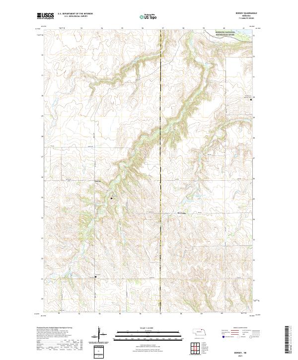
2021 Map of Dorsey
USGS Topo · Published 2021About this map
Dorsey and Knoxville anchor this rural landscape along the border of Holt and Knox counties, where the high plains meet the intricate drainage systems of the Niobrara valley. The northern edge of the map is defined by the protected waters of the Niobrara Wild and Scenic River and the Missouri National Recreation River, indicating the ecological importance of this riparian corridor. Farmland is dissected by numerous waterways, including Steel Cr and Pishel Cr, while local water management is evident at the Bartos Reservoir complex. For those tracing local heritage, the map identifies three distinct burial grounds: the Pischelville National Cem near the river bluffs, the central Dorsey Cem, and Star Cem further south. The terrain is marked by significant features like Long Gulch and Revell Ponds, illustrating the varied topography that has shaped settlement patterns and road networks like 888th Rd.
Find a feature on this map
35 named features on this map. Tap any name to fly to it.
Don’t see what you’re looking for? This feature index may not catch every label — zoom into the map to look around manually.
Map Details
Editions of this 2021 Dorsey Map
This is the sole edition of this map. No revisions or reprints were ever made.
Other maps of this area

1950 · Verdel
USGS Topo · 1:24,000

1950 · Dorsey NW
USGS Topo · 1:24,000

1950 · Lynch
USGS Topo · 1:24,000

1950 · Pishelville
USGS Topo · 1:24,000

1950 · Monowi
USGS Topo · 1:24,000

1952 · Monowi
USGS Topo · 1:24,000

1952 · Dorsey
USGS Topo · 1:24,000

1954 · Walnut
USGS Topo · 1:24,000

1954 · Dorsey SW
USGS Topo · 1:24,000

1954 · Star
USGS Topo · 1:24,000