
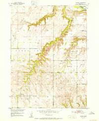
1952 Map of Dorsey
USGS Topo · Published 1952About this map
Dorsey and Knoxville anchor this 1950s study of the borderlands between Holt Co and Knox Co. The landscape is defined by the northern flow of the Niobrara River and a complex network of drainages including Squaw Creek, Steel Creek, and Pishel Creek. This era reveals a rural society organized around small school districts and local parishes, with prominent landmarks such as Old Mill Sch, Knoxville Sch, and Dorsey Ch serving as community hubs.
Find a feature on this map
21 named features on this map. Tap any name to fly to it.
Don’t see what you’re looking for? This feature index may not catch every label — zoom into the map to look around manually.
Map Details
Editions of this 1952 Dorsey Map
2 editions found
Other maps of this area

1950 · Verdel
USGS Topo · 1:24,000

1950 · Dorsey NW
USGS Topo · 1:24,000

1950 · Lynch
USGS Topo · 1:24,000

1950 · Pishelville
USGS Topo · 1:24,000

1950 · Monowi
USGS Topo · 1:24,000

1952 · Monowi
USGS Topo · 1:24,000

1954 · Walnut
USGS Topo · 1:24,000

1954 · Dorsey SW
USGS Topo · 1:24,000

1954 · Star
USGS Topo · 1:24,000

1955 · O'Neill
USGS Topo · 1:250,000