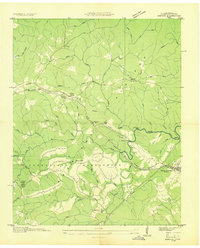
1936 Map of Dorton
USGS Topo · Published 1936About this map
The Cumberland Plateau during the late 1930s reveals a landscape undergoing significant federal transformation. This survey captures the development of Cumberland Homesteads, a New Deal-era subsistence farming community marked by structured residential clusters and the Homestead Sch. The Tennessee Central Railroad and U S Highway No 70 run parallel through the northern corridor, connecting the settlements of Dorton and Crab Orchard.
Find a feature on this map
50 named features on this map. Tap any name to fly to it.
Don’t see what you’re looking for? This feature index may not catch every label — zoom into the map to look around manually.
Map Details
Editions of this 1936 Dorton Map
This is the sole edition of this map. No revisions or reprints were ever made.
Other maps of this area

1887 · Kingston
USGS Topo · 1:125,000

1891 · Kingston
USGS Topo · 1:125,000

1892 · Pikeville
USGS Topo · 1:125,000

1893 · Kingston
USGS Topo · 1:125,000

1895 · Wartburg
USGS Topo · 1:125,000

1895 · Pikeville
USGS Topo · 1:125,000

1896 · Wartburg
USGS Topo · 1:125,000

1897 · Standingstone
USGS Topo · 1:125,000

1898 · Standingstone
USGS Topo · 1:125,000

1912 · Crossville
USGS Topo · 1:62,500