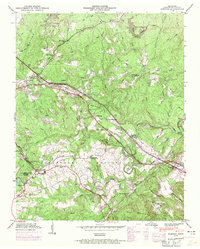
1946 Map of Dorton
USGS Topo · Published 1971About this map
Cumberland Homesteads dominates the southern landscape of this mid-century survey, revealing a unique New Deal-era planned community. This agrarian settlement pattern, featuring the Homestead Sch and Homestead Ch, contrasts with the industrial presence of the Tennessee Central railroad corridor. The rail line serves local hubs like Dorton and Crab Orchard, passing near the Dayton Spur and Otter Creek Junction.
Find a feature on this map
65 named features on this map. Tap any name to fly to it.
Don’t see what you’re looking for? This feature index may not catch every label — zoom into the map to look around manually.
Map Details
Editions of this 1946 Dorton Map
2 editions found
Other maps of this area

1887 · Kingston
USGS Topo · 1:125,000

1891 · Kingston
USGS Topo · 1:125,000

1892 · Pikeville
USGS Topo · 1:125,000

1893 · Kingston
USGS Topo · 1:125,000

1895 · Wartburg
USGS Topo · 1:125,000

1895 · Pikeville
USGS Topo · 1:125,000

1896 · Wartburg
USGS Topo · 1:125,000

1897 · Standingstone
USGS Topo · 1:125,000

1898 · Standingstone
USGS Topo · 1:125,000
1912 · Crossville
USGS Topo · 1:62,500