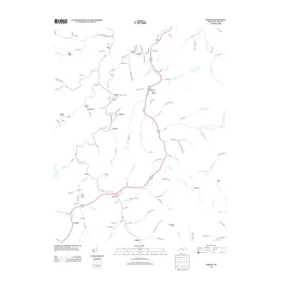
2013 Map of Dorton
USGS Topo · Published 2013About this map
Shelby Cr serves as the primary drainage corridor through this section of Pike County, where narrow hollows and winding creek beds dictate the placement of local communities. Settlements like Jonancy and Virgie are clustered along these waterways, reflecting a classic Appalachian residential pattern. This 2013 landscape is marked by numerous family-named landmarks and small burial grounds, including the Newsome Memorial Cem and Sowards Cem, which provide significant value for genealogists tracing regional roots. Higher elevations are characterized by features such as Sheep Cliff and Threemile Ridge, while the network of secondary roads follows the contours of the land. The concentration of place names like Frogtown, Ellwood, and Myra reveals a densely populated rural corridor connected by the path of the Shelby Cr and its many tributaries.
Find a feature on this map
145 named features on this map. Tap any name to fly to it.
Don’t see what you’re looking for? This feature index may not catch every label — zoom into the map to look around manually.
Map Details
Editions of this 2013 Dorton Map
This is the sole edition of this map. No revisions or reprints were ever made.
Other maps of this area

1886 · Grundy
USGS Topo · 1:125,000

1890 · Whitesburg
USGS Topo · 1:125,000

1890 · Grundy
USGS Topo · 1:125,000

1892 · Grundy
USGS Topo · 1:125,000

1892 · Whitesburg
USGS Topo · 1:125,000

1912 · Pound
USGS Topo · 1:48,000

1913 · Clintwood
USGS Topo · 1:62,500

1914 · Pound
USGS Topo · 1:62,500

1914 · Vergie
USGS Topo · 1:48,000

1915 · Clintwood
USGS Topo · 1:62,500