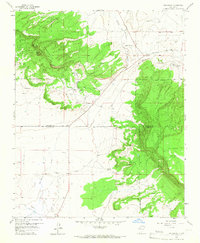
1957 Map of Dos Lomas
USGS Topo · Published 1967About this map
Zia Mines and the Anaconda Mine sit at the center of an intensive uranium exploration era in the high desert of New Mexico. This mid-century survey reveals a landscape transformed by industrial extraction, particularly within Poison Canyon where the Poison Canyon Mine and Barbara J No 1 Mine are documented. The proximity to Navajo Indian Land and the Cibola National Forest highlights the complex land use and jurisdictional boundaries of the region.
Find a feature on this map
30 named features on this map. Tap any name to fly to it.
Don’t see what you’re looking for? This feature index may not catch every label — zoom into the map to look around manually.
Map Details
Editions of this 1957 Dos Lomas Map
3 editions found
Other maps of this area

1883 · Mt. Taylor
USGS Topo · 1:250,000

1886 · Mt. Taylor
USGS Topo · 1:250,000

1892 · Mt. Taylor
USGS Topo · 1:250,000

1899 · Mt. Taylor
USGS Topo · 1:250,000

1957 · Lobo Springs
USGS Topo · 1:24,000

1957 · Ambrosia Lake
USGS Topo · 1:24,000

1957 · Dos Lomas
USGS Topo · 1:24,000

1957 · Bluewater
USGS Topo · 1:24,000

1957 · Goat Mountain
USGS Topo · 1:24,000
1957 · Grants
USGS Topo · 1:24,000