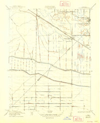
1922 Map of Dos Palos
USGS Topo · Published 1948About this map
Dos Palos and its neighboring agricultural settlements emerge as organized grid systems amidst the complex irrigation networks of the Central Valley in this early 1920s survey. The landscape is defined by the vital San Joaquin and Kings River Canal, which cuts across the territory to support the region's burgeoning farming economy. Transportation is anchored by the Santa Fe railroad line, while the presence of the Old Southern Pacific Grade and the diagonal Swamp Road indicate evolving transit corridors. Further south, the map identifies the rural center of Oro Loma and a specific Oil Pumping Station, signaling the intersection of industrial development and agricultural expansion. The straight-line Boundary Line between Merced and Fresno counties bisects the southern reaches, highlighting the formal division of these intensive land-use zones during a period of significant growth.
Find a feature on this map
11 named features on this map. Tap any name to fly to it.
Don’t see what you’re looking for? This feature index may not catch every label — zoom into the map to look around manually.
Map Details
Editions of this 1922 Dos Palos Map
2 editions found
Other maps of this area

1913 · Panoche
USGS Topo · 1:125,000

1916 · Santa Rita Bridge
USGS Topo · 1:24,000

1916 · Delta Ranch
USGS Topo · 1:24,000

1920 · Santa Rita Bridge
USGS Topo · 1:31,680

1921 · Los Banos
USGS Topo · 1:31,680

1921 · Laguna Seca Ranch
USGS Topo · 1:31,680

1922 · Oxalis
USGS Topo · 1:31,680

1922 · Santa Rita Bridge
USGS Topo · 1:31,680

1922 · Charleston School
USGS Topo · 1:31,680

1922 · Dos Palos
USGS Topo · 1:31,680