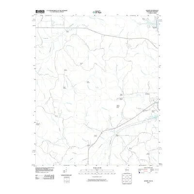
2010 Map of Doskie
USGS Topo · Published 2010About this map
Greenwater Marina and the winding course of Yellow Creek define the eastern edge of this landscape near the Mississippi-Tennessee border. The terrain is characterized by a dense network of named hollows and ridges, including Sorghum Hollow, Gray Hollow, and the uniquely named Yankee Charlie Ridge. Genealogists will find this sheet particularly valuable for its high density of rural burial grounds, ranging from Lambs Chapel Cemetery and Blackard Cemetery in the west to North Cross Roads Cemetery and Old Pleasant Hill Cemetery further east. Water features like Chalybeate Spring and Blue Bill Spring suggest a landscape shaped by natural springs and numerous small tributaries, such as Leitch Mill Branch and Little Yellow Creek, which drain the varied topography of this borderland region in the early 21st century.
Find a feature on this map
87 named features on this map. Tap any name to fly to it.
Don’t see what you’re looking for? This feature index may not catch every label — zoom into the map to look around manually.
Map Details
Editions of this 2010 Doskie Map
This is the sole edition of this map. No revisions or reprints were ever made.
Other maps of this area

1911 · Iuka
USGS Topo · 1:48,000

1914 · Iuka
USGS Topo · 1:62,500

1935 · Doskie
USGS Topo · 1:24,000

1935 · Iuka
USGS Topo · 1:24,000

1935 · Leedy
USGS Topo · 1:24,000

1935 · Glens
USGS Topo · 1:24,000

1936 · Counce
USGS Topo · 1:24,000

1936 · Kendrick
USGS Topo · 1:24,000

1936 · Shaws
USGS Topo · 1:24,000

1936 · Pickwick
USGS Topo · 1:24,000